Europe challenged by increasing scale and frequency of forest fires
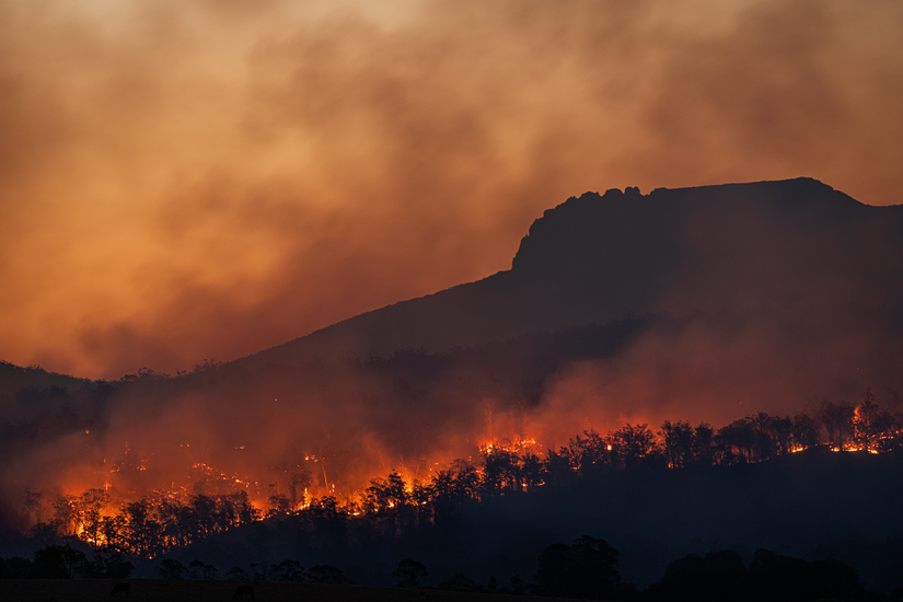
A scorching summer has left a devastating mark across the European Union, with more than 400,000 hectares burned[1] in a wave of forest fires that have ravaged parts of Spain, Greece, and Italy in particular.
Greece tops the list of European countries with the largest area burned so far this year, at more than 165,000 hectares. The ongoing fire in the Evros region on the border with Turkey has so far consumed more than 80,000 hectares alone,[2] making it the largest fire ever recorded in Europe. After Greece, Spain is the second most affected country with 84,545 hectares burned by fires, followed by Italy with 67,134.[3]
The large fires that have raged out of control in recent years have highlighted the urgent need to address not only the challenges of firefighting, but also prevention and awareness of the underlying causes. The increasing frequency of these fires and the scarcity of resources to fight them underline the crucial importance of public cooperation to prevent greater tragedies. In this regard, it is essential to educate the population on the values of respect, sustainable practices, nature conservation, and what to do in the event of a fire, emphasizing three key points: act quickly, evacuate immediately, and seek shelter.
The number of days with extreme fire risk has increased worldwide over the last 40 years, particularly in the Mediterranean basin, where it has doubled.[4],[5] It is also important to note that climate anomalies that trigger heat waves and severe droughts make it more difficult to control and fight forest fires. These factors are exacerbated by the abandonment of rural areas, the lack of forest clearing, the homogeneity of forest species, and the decline in productive activities aimed at profitable and sustainable forest use.
Concerned about this situation, and anticipating that fighting forest fires will become even more difficult as climate change continues, the European Union decided to take action by launching the FirEUrisk project in April 2021 as part of the Horizon 2020 framework program. The aim of this project is to develop a scientific strategy to prevent and respond to forest fires in Europe by promoting prevention rather than firefighting. FirEUrisk seeks to transform forest fire management by developing solutions, services, and knowledge to address current and projected forest fire challenges in Europe. Marta Gómez Giménez, Project Manager in the Remote Sensing and Geospatial Analytics Division of GMV’s Mission Systems and Applications Unit, believes that “understanding whether the observed phenomena are local or whether the lessons learned can be extrapolated to other areas is crucial for conserving biodiversity, avoiding negative impacts on carbon cycles, and achieving sustainable socio-economic development in different countries.”
As part of FirEUrisk, GMV coordinates the assessment of cascade effects of forest fires, such as soil erosion and landslides on bare/fragile soils, air pollution, and effects linked to other risks, such as biotic disturbances and forest mortality. These cascade effects include several challenges related to rising temperatures, prolonged droughts, soil compaction, and biomass loss, among others. The combination of these factors significantly increases the impact of natural disasters, as demonstrated by storm DANA in Greece and the Mediterranean. It caused landslides and severe flooding, exacerbated by the reduced absorptive capacity of the burned soil, which no longer functions as it did before the fire, allowing excess rain to wash away the topsoil.
FirEurisk aims to combine scientific and industrial efforts to develop an integrated scientific strategy to prepare ecosystems and society for future fires, taking into account the different situations in Europe in terms of response capacity, operational experience, and equipment, among other factors.
GMV has been involved in projects co-funded by the European Commission for more than 20 years, focusing on issues such as fire ecology and better prevention and emergency planning through the Copernicus Emergency Management Service (EMS) Rapid Mapping. Projects such as FirEUrisk demonstrate the usefulness of satellite data for quantifying burned areas, preparing fuel maps, and raising community awareness. Integrating this geospatial data in holistic approaches is crucial to predict, monitor, and evaluate the causes and consequences of fires comprehensively, which will help improve decision-making.