The new role of highly accurate and safe GNSS in automobiles
Global Navigation Satellite Systems (especially the North American system, GPS, and the European Galileo) technology is completely integrated into our daily activities. We have incorporated it in our vehicles, handheld, wearables, and IoT devices, and we have utterly assimilated self-location awareness at every moment and everywhere.
One of the most well-known applications of GNSS is its use for door-to-door navigation. It is particularly frustrating to the author of this article to hear people outside, TV shows, newspapers, etc., constantly calling “GPS” to the navigator application. The fact is that “GPS” (even that term is not rigorous enough, since we should use “GNSS” because we also have other systems such as Galileo, BeiDou, Glonass, etc.) is the technology that enables a device to know its current position, velocity, and course. Then, how to navigate across the streets and roads to reach an address is the merit of the maps and the path/determination algorithms inside the navigation device.
Probably because of the above, and talking already about the automotive market, there is still this traditional view to associate GNSS systems with the multimedia area, where the navigation function tends to be included. For these classic GNSS applications (including emergency calls), standalone GNSS, providing accuracy figures of 5-10m or 3-5m for single frequency or dual frequency approaches, respectively, is probably enough. And this can be accepted, especially considering that accuracy can be increased up to 1-3m by using augmentation systems such as DGNSS or SBAS.
However, those accuracy levels are not enough to meet the most demanding requirements of emerging applications in cooperative systems or autonomous driving. The systems used must be capable of progressively increasing the availability of the overall localization function and the mentioned level of accuracy. Here is where highly accurate GNSS systems (PPP, PPP-RTK, RTK) enter since they can reach centimetric accuracy while providing complementary characteristics to local sensors such as radars, cameras, and LiDAR and fill this role of precisely locating the vehicle.
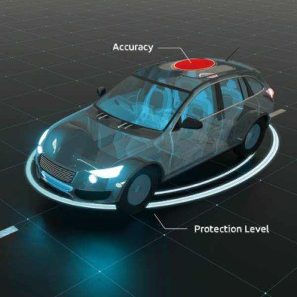
Additionally, we must go beyond accuracy for applications where safety is a key concept, such as autonomous driving. It is useless to have accurate positions if we have no clue whether the position we are using as input to a safety system is compromised or erroneous. We need a “safe” position, which means an accurate and trustworthy location. To get it, we must implement the concept of integrity associated with the position, which becomes safe and reliable thanks to the ability to detect and exclude sources of error and hazards affecting the positioning data in real time. One of the consequences of a safe position is that we can calculate a confidence area around the computed position, defined by what is known as the protection level. The probability of erroneous positioning information is extremely low and below a demanding target probability (the Target Integrity Risk or TIR) within the confidence area. The smaller the TIR, the bigger would need to be the protection level to cover all cases.
In addition to the protection level, compliance with standards like ISO 26262 or ISO 21448 (SOTIF) and the concept of integrity allow the system to reach a proper rating of ASIL (Automotive Safety Integrity Level) and integrate GNSS with other ASIL-rated subsystems to contribute to the safety case of the vehicle.
As we have already stated, GNSS makes real sense in AD when combined with other components. GNSS alone cannot be used to guide an autonomous car, even if we remove surroundings from the equation, as the system has limitations, especially when the view of the sky is partially blocked in urban areas or in tunnels. In those cases, integration with other sensors, such as IMU and wheel odometry enable continued use of the localization function by providing a relative position to the last known GNSS location. If we also think about how autonomous cars work, we realize that there are numerous other sensors in cars, such as radars, LiDAR, and cameras, that take the role of human eyes as part of the vehicle ‘perception’ system. With Artificial Intelligence, perception provides the vehicle with awareness of its surroundings and obstacles, both static and dynamic, expected and unexpected. Together the perception system, the AI and the positioning system providing global location, speed, and heading of the vehicle, are the crucial components of ADAS in autonomous driving.
In the overall system, high precision and safe GNSS solutions present independency, from the architectural point of view, concerning the perception sensors and mapping. According to ISO 26262-9, combining independent subsystems with a lower level of ASIL (ASIL-B) to implement redundancy can enable a location system with a higher level of safety (e.g., ASIL-D). As a result, by using high-accuracy and safe GNSS systems that can achieve ASIL-B level as an additional piece of the safety case of the vehicle, the OEM can reach the highest levels of safety required. This is especially relevant if we consider that GNSS is a sensor with an affordable cost and that can work in different environments and all-weather conditions, including situations with no visual references that do affect other ADAS sensors, like highways across deserts, roads with snow that is hiding the lanes, etc.
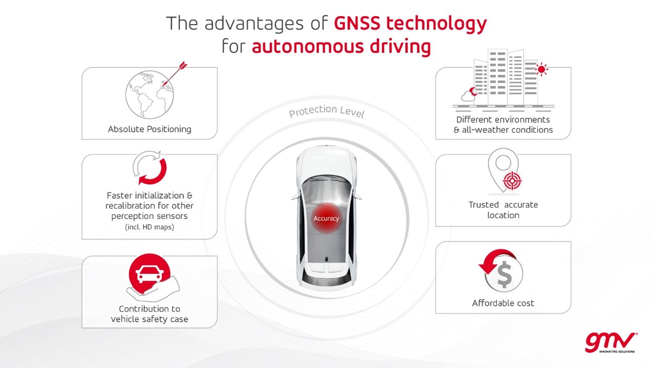
In addition to the contribution to the safety case, GNSS can also be used to provide perception systems with initialization and calibration data, leading to more efficient use of platform resources. It provides an independent and reliable input for dynamically updating HD maps (via SLAM techniques or others). Also, the combination of accurate position plus protection level can be a crucial mean to uniquely determine the detection of entering or leaving a virtual geographic boundary (geofencing). This is particularly relevant in automated driving to ensure that the vehicle has entered certain infrastructures (e.g., a highway) where a higher level of automation is allowed. The number of applications for trusted and safe positioning is increasing daily.
Main OEMs are starting to discover the benefits that solutions such as PointSafe® for Automotive, supplied by u-blox and powered by GMV GSharp® for Automotive, can provide to the use cases mentioned in this article. For now, they are starting to apply the technology to specific vehicle models, in line with the progressive incorporation of automated driving functions, but it is expected that the market for these applications will increase dramatically in the coming years.
Therefore, GNSS still has a long road ahead in automotive.
Author: Carlos Busnadiego Gutiérrez